Home >
AGS >
News Articles >
Malaysia >
Smart mapping and geographic information system to assist authorities with Covid-19 monitoring
Smart mapping and geographic information system to assist authorities with Covid-19 monitoring
Apr 7, 2020 | Malaysia
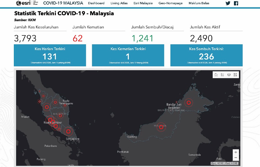
Geographic Information System (GIS) technology company Esri Malaysia has launched a Covid-19 GIS Hub website to collate official information from government authorities, aimed at benefiting related agencies and the public. The Esri Covid-19 GIS hub monitors the virus outbreak both globally and locally in real-time. Locally, Esri Malaysia uses the map to pin confirmed and active cases, deaths and recoveries to identify where Covid-19 infections have been recorded. “This smart mapping efforts will provide a clearer picture of our situation and with the information available, the local authorities can better monitor its spread with more efficiency and in various aspects including the movement of a community or even coordinating a safety/health team,” said Esri Malaysia’s CEO, C.S. Tan.